


Voting District 20, Cherokee County, Oklahoma
About
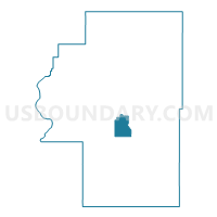
Outline

Summary
| Unique Area Identifier | 653681 |
| Name | Voting District 20 |
| County | Cherokee County |
| State | Oklahoma |
| Area (square miles) | 9.70 |
| Land Area (square miles) | 9.65 |
| Water Area (square miles) | 0.04 |
| % of Land Area | 99.54 |
| % of Water Area | 0.46 |
| Latitude of the Internal Point | 35.85302560 |
| Longtitude of the Internal Point | -94.99880910 |
Maps


Graphs
Select a template below for downloading or customizing gragh for Voting District 20, Cherokee County, Oklahoma


Neighbors
Neighoring Voting District (by Name) Neighboring Voting District on the Map
- Voting District 10, Cherokee County, OK
- Voting District 19, Cherokee County, OK
- Voting District 2, Cherokee County, OK
- Voting District 3, Cherokee County, OK